|
Kalgan River |
| Kalgan River at a glance | |||
| Catchment area: | 2562 square kilometres |
||
| Average annual rainfall over catchment: | 600 millimetres | ||
| River length: | 140 kilometres | ||
| Annual discharge volume: | 53,400 Megalitres | ||
| Extent of tidal influence: | nine kilometres | ||
| Percentage cleared: | 66% | ||
| River health: | marginally saline to brackish | ||
Although salinity and heavy grazing have taken their toll on the fringing vegataion along the river in the upper catchment and also along the major tributaries lower down, most of the main channels are habitat rivers, with only a few sections of agricultural drain. Tributaries within or alongside the Stirling Range National Park are near pristine or relatively natural.
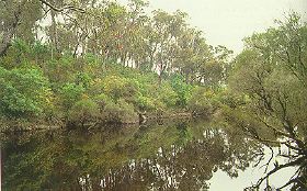
The lower nine kilometres of the river takes the form of a drowned river valley with steep hillsides of forest and farmland, and the occasional outcrop of granite. This part of the river is a major feature of the Albany region, and is used for scenic boat tours.
In 2005 a project (Our Living Rivers) was set up to collect and analyse data, enabling the Department of Water to monitor the health of the river over time and help determine what systems need better protection. In spring 2006 and 2007 samples were taken from the river system to assess the quality of the water and habitat as well as the presence of fish and macroinvertebrates. Three sites were sampled on the Kalgan River system, three sites on Napier Creek and two sites on Chelgiup Creek. One site on the Takenup Brook, Little Creek and Churchlane Creek were also sampled..
Further Information:
Albany Waterways Resource Book: Water and Rivers Commission 1999
South Coast Regional Land and Water Care Strategy: The Albany Hinterland Sub-region. Prepared by the South Coast Regional Assessment Panel and the South Coast Regional Initiative Planning Team: December 1996