|
King River |
| King River at a glance | |||
| Catchment area: | 402 square kilometres |
||
| Average annual rainfall over catchment: | 860 millimetres | ||
| River length: | 27 kilometres | ||
| Annual discharge volume into Oyster Harbour: | 34,126 Megalitres | ||
| Extent of tidal influence: | seven kilometres | ||
| Percentage cleared: | 83% | ||
| River health: | fresh | ||
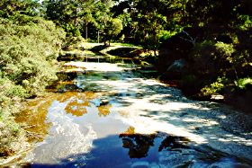
Despite heavy clearing within the catchment, the water remains fresh. Most of the main channels are either habitat rivers or agricultural drains, but Mill Brook, a major tributary passing through a nature reserve, is relatively natural.
Further Information:
Albany Waterways Resource Book: Water and Rivers Commission 1999
South Coast Regional Land and Water Care Strategy: The Albany Hinterland Sub-region. Prepared by the South Coast Regional Assessment Panel and the South Coast Regional Initiative Planning Team: December 1996