 |
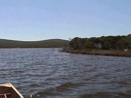
Broke Inlet |
| Broke Inlet at a glance | |||
| Location: | 19 kilometres west of Walpole |
||
| Catchment area: | 928 square kilometres |
||
| Average annual rainfall over catchment: | 1350 millimetres | ||
| Percentage catchment cleared: | 4.5% | ||
| Inlet area: | 4800 hectares | ||
| Inlet volume: | 72M cubic metres | ||
| Annual flow into Broke Inlet: | 187M cubic metres | ||
| Flow to estuary: | 157M cubic metres | ||
| Data selection | |||

Surface salinity varies from around 5 ppt when the river is flowing in summer to 30 ppt or more at the end of summer, but both lower and higher measurements (up to sea water, at 35 ppt) have been observed. There is great variation from year to year depending on the volume of the river and the time and duration of the bar opening. Mixing is rapid in the open water of the lagoon, and the salinity is generally uniform throughout the lagoon and from top to bottom, except when the river is flowing strongly.
Observed water temperature in the inlet varies from 11 to 22°C. The clarity of the water varies greatly, depending on the degree of wind. The surface water is well oxygenated, and this is probably true for all the water in the lagoon.
Sampling has shown uniformly low levels of total phosphorus, most 0.01 mg/litre or less. Limited sampling has also shown low nitrogen levels (<0.5 mg/litre Total N and 0.02 mg/litre nitrate).
Further Information:
Estuaries and Coastal Lagoons of South Western Australia. Broke Inlet and other estuaries of the Shire of Manjimup. Environmental Protection Authority; Perth, Western Australia. Estuarine Studies Series Number 6: September 1989