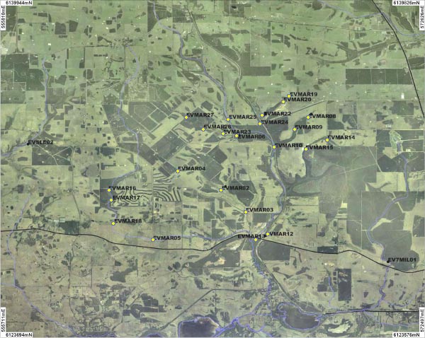
27 sites (MAR01 - MAR27) across the Marbellup Brook catchment were sampled. An overview of this sites is shown on the map above. Photographs are available for some of the sites:
| MAR01 | MAR02 | MAR03 | MAR04 | MAR11 | MAR12 | MAR13 | MAR14 | MAR15 |
The upper Marbellup Brook catchment consists of a low forest of Jarrah and Sheoak. The floodplain mainly consists of sedgeland. Since European settlement approximately 80% of the catchment has been cleared for agriculture.
Originally the Brook would have flowed in Lake Powell before overflowing in Lake Manarup and Torbay Inlet. Artificial drainage that was constructed across the catchment in the 1950s, directed the flow away from Lake Powell and straight into the Inlet.
The Marbellup Brook was sampled between May 2006 and September 2007.
The Marbellup Brook is a fresh water and neutral system. The Brook recorded very high average levels of turbidity (50.4 ntu), total nitrogen (1731μg/L) and total phosphorus (266μg/L) across the catchment.
