|
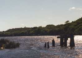
Torbay Inlet |
| Torbay Inlet at a glance | |||
| Total catchment area: | 330 square kilometres | ||
| Average annual rainfall over catchment: | 800 - 1000 millimetres | ||
| Total cleared | 55% | ||
| Length of catchment waterways: | 244 kilometres | ||
Much of the land surrounding Torbay Inlet is only one half to one metre above sea level and on occasions throughout the year the land was inundated by saltwater that flooded back up the estuary. A barrage with floodgates was built across the narrow channel linking Torbay Inlet and Lake Manarup in 1912 to unsuccessfully try and prevent the flooding of saltwater back onto farmland. As a result of draining agricultural land the estuary is high in nutrients but not overly eutrophic.
The Watershed Torbay project has been set up to try and prevent any further eutrophication of the system in the future.
In 2005 a project (Our Living Rivers) was set up to collect and analyse data, enabling the Department of Water to monitor the health of the river over time and help determine what systems need better protection. In spring 2006 and 2007 samples were taken from the river system to assess the quality of the water and habitat as well as the presence of fish and macroinvertebrates. Twenty-seven sites were sampled on Marbellup Brook, which feeds into the inlet. In addition, one site was sampled on Seven Mile Creek, which lows to Lake Powell and eventually into the Torbay Inlet.
Further Information:
South Coast Regional Land and Water Care Strategy: The Albany Hinterland Sub-region. Prepared by: the South Coast Regional Assessment Panel and the South Coast Regional Initiative Planning Team: December 1996.