|
Dalyup and West Dalyup River |
| Dalyup/West Dalyup Rivers at a glance | |||
| River length: | 54 kilometres | ||
| Annual discharge volume: | 11,000 Megalitres | ||
| River health: | Brackish | ||
The Dalyup and West Dalyup rivers formed thirty million years ago (during the Oligocene period) when the Darling Plateau uplifted and the southern coastline tilted toward the south to form the Ravensthorpe Ramp. This partly rejuvenated the rivers and they started to drain in a southerly direction instead of the previous east-west direction. Over time the rivers etched the weathered profile and sandplain, exposing granite along the bottom of drainage lines and left remnant Tertiary sedimentary rock with lateritic profiles exposed on the flanks of low hills.
The Dalyup River is the primary source of water supply to Lake Gore. Lake Gore is a large permanent lake fringed with paperbarks. It is a naturally saline lake that covers an area of 738 hectares with 699 hectares being open water. When Lake Gore is full, it overflows via Overflow Swamp along a small, deep creek into Quallilup Lake. In exceptionally wet years (for example 1986 and 1989), the Coobidge Creek system (including Lake Carbul, Kubitch and Gidong Lakes) and the Dalyup System merge, and flow via an ill-defined watercourse westwards from Overflow Swamp approximately 12 kilometres to Barker's Inlet and the ocean.
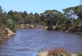
The Dalyup River is an ephemeral system that flows mainly after winter rains. Summer flows are generally due to groundwater influxes from the surrounding land. The river consists of numerous pools that form important wildlife habitat during summer months. These river pools then join during the winter months as the rain begins to fill the low-flow channel.
The Dalyup River system has flooded on average about every ten years. The first flood to be noted by locals was in the 1940s. The first damaging flood was around 1968/69. Since then flooding has occurred in 1979, 1989, 1999 and 2000. Joy Marold has lived on the western side of Lake Gore since the 1960s and she remembers that Lake Gore in the 1960s was very dry with a small amount of water and a large amount of mud. Since the 1968/69 flood Lake Gore has been full and hardly ever dry. However, that flood was minor compared to the following ones in 1989, 1999 and 2000.
Water quality
There has been no comprehensive water quality monitoring programs undertaken in the catchment. Various spot sampling projects have been undertaken by various agencies. This includes monitoring undertaken by Tim Setter (as part of a Murdoch University course), the Department of Environment, the Shire of Esperance, students from Esperance Senior High School (Ribbons of Blue), the Department of Conservation and Land Management (CALM) and the Esperance Downs Research Station (EDRS).
The water quality in the Dalyup and West Dalyup rivers is brackish on average and ranges from half to almost twice that of seawater. It is likely that the salinity levels have increased in the Dalyup River due to secondary salinity.
Salinity
A 'snapshot' done by the Water and Rivers Commission in July 2000 recorded conductivity levels of the Dalyup and West Dalyup rivers ranging from 25.3 mS/cm to 70.3 mS/cm. Setter also recorded salinity readings from March to June 1998. These levels ranged from 30 to 70 mS/cm (which is approximately 60 to 140% the salinity of seawater). Lake Gore monitoring recorded salinity levels of 130 mS/cm.
Dalyup River Snapshot
Catherine Field on behalf of the Water and Rivers Commission in July 2000 carried out a "snapshot" of the Dalyup River. The catchment had received rainfall the day before the sampling and the waterways were flowing. Eight sites were selected in the Dalyup catchment including four sites on the Dalyup River, three sites on the West Dalyup River and one site on Dalyup River Tributary one (The Oaks property). The water quality sampling included, measuring conductivity water temperature and observations of flow and sedimentation.
The conductivity readings from the Dalyup, West Dalyup and Dalyup Tributary One ranged from 25.3 mS/cm70 to.3 mS/cm. The salinity levels decreased further down the catchment suggesting that the water was being diluted with fresh rainwater flowing into the river. Near the bottom of the catchment the Dalyup River measured 31.5 mS/cm at the Dalyup Poineer Reserve, and 70.3 mS/cm (West Dalyup River) and 51.7 mS/cm (Dalyup River) near the top. For comparison, the conductivity of seawater is 53 mS/cm.
Nutrients
(Information collated by Steve Gee, AgWA, Esperance)
Since 1995, water draining from the Esperance Research Station has been monitored for nitrogen (N) and phosphorous (P) to determine the quality of water as it passes through a large block of remnant bush into a tributary of the Dalyup River. Results indicate high levels of nutrients are being discharged into tributaries of the Dalyup River. Preliminary data indicated high nitrogen and phosphorous concentrations that ranged from 3.5 mg/L and 11 mg/L respectively. Australian and New Zealand Environment and Conservation Council (ANZECC, 1992) water quality guidelines suggest that total phosphorous should be less than 0.1 mg/L and total nitrogen should be less than 0.75 mg/L.
Setter (unpub.) also monitored nutrients including total nitrogen and total phosphorous between March and June 1998 along the Dalyup and West Dalyup River. Total nitrogen was also extremely high ranging from 2 to 8 mg/L at the beginning of the season. Total phosphorous ranged from 0.01 to 0.7 mg/L. Half the survey locations, including Dalyup River and West Dalyup River, were above the ANZECC guidelines.
Flow rates of the Dalyup River
There has been no long-term flow monitoring of the Dalyup and West Dalyup rivers. A mean annual flow of 11,000 ML has been estimated by Pen, who also considered that flow rates have increased two to four times since clearing. Setter has undertaken some monitoring of flow rates and recorded maximum flow rates between March and September 1998 of 25 cubic metres/min for the Dalyup and 8 cubic metres/min for the West Dalyup River. During sampling the Dalyup River had a greater flow rate than the West Dalyup. Flow rates were gained using stream cross-sectional area and stream velocity calculations.
AgWest also monitored discharge from the eastern side of the Esperance Research Station. In July 1995, flow rates reached approximately 500 cubic metres/hour (14 cm on rating curve). The volume of discharge water passing Site 2 was approximately 83400 cubic metres during the 75 days from 16 July 1995 to 28 September 1995. During this period there was 161 millimetres of rainfall recorded. The discharge at Site 2 represents approximately 26% of the total rainfall (over the 75 days) in the drainage network catchment.
Flood events 1999 and 2000
In January 1999, a significant flood event occurred in the Lake Gore catchment. The Dalyup and West Dalyup rivers sustained severe flood damage. Bridges, road crossings and fences were lost. The river channels were severely eroded and massive amounts of sediment were dumped into the channel and river pools.
In March 2000, another storm event produced a flood estimated to be slightly greater in magnitude than the 1999 event. The rainfall was estimated to be about 110 mm over a 24-hour period. This corresponds to an Average Recurrence Interval (ARI) of 50 to 100 years. This means that it would be most unlikely to occur more than once in a 50 to 100-year period. The annual rainfall in the catchment normally varies from about 330 to 680 mm. During the March 2000 flood, peak discharge of the Dalyup River at the bridge was calculated to be about 300 cubic metres /second and at the West Dalyup bridge to be 200 to 250 cubic metres /second with estimated average velocities of 3.9 and 3.5-3.8 metres / second respectively.
Macroinvertebrates
Macroinvertebrates consist of worms, snails, crustaceans (prawns and marron) and insects (such as mayflies, stoneflies, beetles, and bugs). Many macroinvertebrate species are found in the waterways throughout the Dalyup River catchment. A comprehensive monitoring program, including water quality monitoring to detect long-term changes to the health of the river system, is recommended.
Macroinvertebrates play an important role in the ecology of the river system. In the upper catchment, macroinvertebrates are responsible for shredding larger particles including bark, leaves and other detritus that falls into the waterway. Further downstream, macroinvertebrates such as worms, gilgie and marron take small particles of organic matter from the sediment and digest them further. Algae that grow on the rocks is `scraped off' by snails and limpets. There are also predator species of macroinvertebrates including the dragon fly, adult beetles and stonefly larvae that prey on smaller animals.
The quality of the water is linked to the survival of macroinvertebrates and in turn larger animals such as fish. Macroinvertebrates are sensitive to changes in the physical and chemical conditions of the water, including salinity, flow and temperature.
The most important feature in a stream is vegetation - including logs, branches, bark and leaves. This forms the basis of a food web for macroinvertebrates in our waterways. Vegetation removal can impact on food availability, light penetration, water flow, sediment levels, and temperature of the water. Protection of foreshore vegetation is vital to ensure the protection of the ecological attributes of our river system. Removal of riparian vegetation upstream can have serious consequence on downstream macroinvertebrates that rely on the input of organic matter to the system.
Macroinvertebrates have been sampled as part of the National Rivers Health Program. The Dalyup River was sampled as a test site in 1997. Only a few species of macroinvertebrates were sampled.
Macroinvertebrate species collected in the Dalyup River as part of the National River Health Program.
| Site Name | Date | Sample location | Scientific Name Family | Common Name |
|---|---|---|---|---|
| ESP13 | 13/09/1997 | Channel | Ceinidae | Mayfly larvae |
| ESP13 | 13/09/1997 | Channel | Ceratopogonidae | Biting midge larvae |
| ESP13 | 13/09/1997 | Channel | Culicidae | Mosquito larvae |
| ESP13 | 13/09/1997 | Channel | Ephydridae | Fly larvae |
| ESP13 | 13/09/1997 | Channel | Orthocladiinae * | Non-biting midge larvae |
| ESP13 | 13/09/1997 | Channel | Oligochaete indeterm. | Aquatic worm. |
Wallace Hardyhead (also commonly known as Western Hardyhead) are small, silvery fish that tend to swim around in schools. It generally is an olive-green colour with silvery sheen on its sides and belly. It is normally seen in schools hear the surface or around the shoreline vegetation and log debris. Spawning occurs during spring and summer months. The diet consists largely of insects and small crustaceans.
Spotted Minnow (Galaxias maculatus or Galaxias truttaceus) is a small fish that is found in a variety of habitats, but is most common in still or slow-flowing waters, mainly in streams, rivers and lakes within a short distance of sea. They can survive in salinities upto 50 ppt.
Swan River Gobies are fish with a brown or tan colour and narrow darker brown blotches. It is silvery white colour on the belly, and the dorsal fins may have irregular blackish stripes. This species is also commonly known as a blue spotted goby as it has a black or blue spot on the dorsal fin. It is found in many parts of Australia and inhabits streams, ponds and brackish estuaries. It is usually found over mud bottoms, sometimes among weeds or adjacent to rocky areas. Spawning occurs during spring, and each female deposit up to 150 eggs. The male guards the eggs during the incubation periods. The larvae then often migrate to fresh water however there is evidence that some populations are landlocked. The diet consists mainly of insects, crustaceans and algae.
Chlorophyll and Algae
There has been no long term monitoring programs for macrophytes, phytoplankton or algae in the Dalyup River, West Dalyup River or Lake Gore. Chlorophyll levels were all above the ANZECC maximum guidelines of 40ug/L in the Dalyup River and Lake Gore when measured in the 1990s. The highest chlorophyll concentrations were associated with an algae bloom in Lake Gore which reached over 120ug/L.
Overall condition of the Dalyup and West Dalyup River
The Dalyup and West Dalyup Rivers are currently showing signs of degradation similar to other rivers in Western Australia. In particular, the riparian vegetation is degrading due to stock access, salinity, waterlogging and weed invasion. The flood plain, which the river flows through, shows extensive flood damage, including formation of secondary channels, head-cuts and severe erosion across farmland.
In addition, catchment changes including rising groundwater levels, increasing salinity and nutrient levels draining from the catchment, are likely to impact on the water quality in Lake Gore. There are weeds proliferating along the rivers, particularly where the floodwaters have deposited seeds. The river is also coping with increased volumes of water coming off a catchment that is cleared, resulting in unstable banks and subsequent erosion and sedimentation of river pools.
There are however sections of the Dalyup and West Dalyup River in good to excellent condition with foreshore vegetation graded as A and B grade. Considerable works have been undertaken to protect and restore the Dalyup River. Most of the river is fenced and many landholders had planned to fence their section river in the future. Many fences were lost during the 1999 and 2000 flood event and most landholders have re-fenced these areas. Considerable areas have also been revegetated - particularly in the upper sections where the river system is showing signs of secondary salinity. There are however considerable areas of the river that require revegetation, particularly sections graded as C and D grade.
The survey results highlighted the flood impacts in the lower section of the river, particularly erosion, bank subsidence, sedimentation and the loss of riparian vegetation. Many landholders recorded the height of the flood levels in the 1999 and 2000 floods, noting that the second flood in 2000 caused more damage than the first - even though there was less rainfall.
Almost every farmer surveyed had conducted some river restoration works on their property and had planned to conduct further works in the future.
| Total River length (km) | Fenced left bank (km) | Fenced right bank (km) |
|
|---|---|---|---|
| Dalyup River (above Griffiths Rd) | 48 | 33 (69%) 15km remaining to fence | 44 (92%) 4km remaining to fence |
| West Dalyup River (to Raszyk Rd) | 41 | 36 (88%) 6km remaining to fence | 32 (78%) 9km remaining to fence |
| Major tributary (to Norseman/Esperance railway line) | 24 | 17 (71%) 7 km remaining to fence | 22 (92%) 2km remaining to fence |
Foreshore vegetation condition of the Dalyup and West Dalyup River (%)
| Vegetation condition | Hectares | % | Sum % |
|---|---|---|---|
| A1 | 0 | 0 | A grade - %9.6 |
| A2 | 26.8 | 1.4 | |
| A3 | 160 | 8.2 | |
| B1 | 395 | 20.2 | B grade - %53.9 |
| B2 | 416.32 | 21.3 | |
| B3 | 241.83 | 12.4 | |
| C1 | 140.5 | 7.2 | C grade - %21 |
| C2 | 151 | 7.7 | |
| C3 | 119.4 | 6.1 | |
| D1 | 166 | 8.5 | D grade - % 14.4 |
| D2 | 70.3 | 4 | |
| D3 | 37 | 1.9 |
| Foreshore vegetation |
|
| Catchment hydrology |
|
| Water quality |
|
| Salinisation and waterlogging |
|
| Erosion |
|
| Sedimentation |
|
| River crossings |
|
| Floods |
|
| Drainage |
|
| Weeds |
|
| Refuse sites |
|
| Lack of appreciation and understanding of rivers |
|
We began our survey in the upper catchment, where the river is a wide valley, containing a series of naturally saline wetlands. As we walked towards the coast, the river became more defined before it ended at Lake Gore. Along the walk, we recorded river pools, habitat values, vegetation type and condition, weeds, fencing status and channel stability (erosion, sedimentation, bank slumping)
The upper sections of the river were in some places over a kilometre wide. There was little or no water in the upper sections, or remnant of it in a series of pools located along the main channel. Samphire dominated this vegetation in the low flow channels, and mallee vegetation on the outer fringe of the river.
The middle sections of the river flowed in steeper, more defined channels and the water cascaded over the granite rocks. This was a beautiful area of the river where the water has cut through about two metres of granite over millions of years. At this time of the year, the river was confined to a two-metre channel, however it would flow over the rocks during periods of high flow, adding oxygen to the water - important for aquatic fauna including native fish. This section of the river was contained within a wide buffer of vegetation, protecting it from the surrounding landuse and ensuring its long-term survival.
As we moved further down the catchment, the river channel became `braided' into a series of intertwining channels, a completely different looking river than upstream. Towards the South Coast Highway, the river fanned out into a flood plain - posing many challenges for farmers in that area.
There were numerous river pools found along the river channel, some of which were several hundred metres long. These pools are important as a refuge for wildlife including various birds during the dry seasons, and are a home to our native fish and macroinvertebrates (water bugs). As we walked along the river, it was easy to see that the river corridor is an important habitat for various birds, frogs, native fish, macroinvertebrates, kangaroos, and the odd Tiger Snake - that we carefully avoided.
Moving south of the highway, the river channel changed considerably as the land tilted more towards the coast. This corresponds to a deeper, faster flowing river with steep banks. The higher energy environment was demonstrated during the last flood events and it was hard not to feel despondent at the numerous fences that were seen trapped in debris along the river channel. On a positive note, the amount of fencing lost indicated that a lot of landholders had fenced considerable kilometres of the river, often at their own expense and in their own time. It also indicated the challenges that many landholders faced in the future to protect the Dalyup River.
Many of the landholders that we met along the way had begun to re-fence the river from the previous flood, this time a little further out! This indicated the commitment of the landholders in the catchment to protect their river. This will help to ensure the long-term protection of the Dalyup River, whilst encouraging a stable river environment that can cope with future flood events (the inevitable habit of rivers).
Dalyup River - A River in a Landscape
Steve Janicke, Water and Rivers Commission.
Steve Janicke undertook a fluvial geomorphology survey of the Dalyup and West Dalyup River in 2000. The survey covered the Dalyup River from Lake Gore to Brownings Road and the West Dalyup River from its junction with the Dalyup River to Brownings Road. The survey recorded floodplain and channel features including erosion points, areas of severe subsidence, sediment loads in the river system, head cuts, and the actual form of the river.
The survey outcomes indicated that the type and extent vegetation were critical factors in maintaining stable river channels and flood plains. The survey noted that rocky and V-shaped valleys in the middle sections of both branches of the Dalyup were more stable - upstream and downstream - than the broader floodplain areas, although in many places the sides of the valleys showed signs of severe weakening and erosion.
The survey recorded where the floods had widened the channel. It could be seen in some areas that the native vegetation, particularly sedges, rushes and other shrubs held the banks and bed material in place against the flood's considerable force of the floods. The floods quickly stripped away pasture and weedy areas first and then huge quantities of soil.
The creation of new flood channels was particularly evident in the ten kilometre section of the river immediately upstream of Lake Gore. Water flowed out of the existing channel, formed new pathways and exposed the existing strengths and weaknesses of the floodplain.
Erosion and sedimentation are a consequence of increased runoff due to catchment clearing and degraded foreshore vegetation. An increase in runoff means a wider and deeper channel forms to cope with the increased volume of water. The process of building a bigger channel results in active erosion of the riverbanks and the riverbed.
Living Rivers
In 2005 a project was set up to collect and analyse data, enabling the Department of Water to monitor the health of the river over time and help determine what systems need better protection. In spring 2006 and 2007 samples were taken from the river system to assess the quality of the water and habitat as well as the presence of fish and macroinvertebrates. Four sites were sampled on the Dalyup River system.
Further Information:
South Coast Regional Land and Water Care Strategy: The Esperance-Sandplain Sub-region. Prepared by: the South Coast Regional Assessment Panel and the South Coast Regional Initiative Planning Team, February 1997.