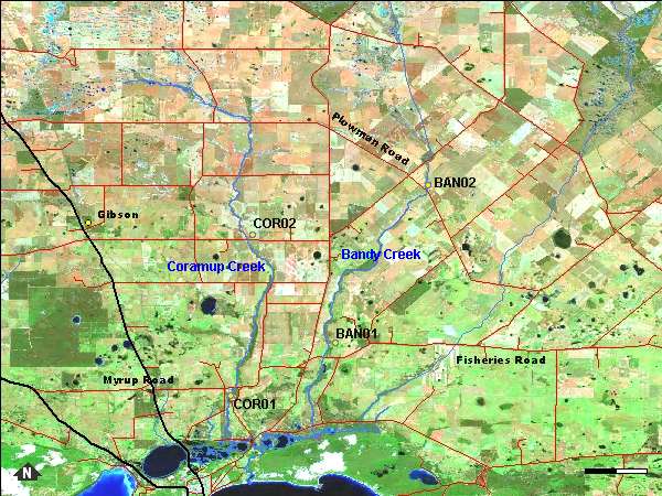
Two sites were sampled on Bandy Creek, and two on Coramup Creek; they are shown on the map above. Photographs are available for each site:
| BAN01 | BAN02 | COR01 | COR02 |
This creek is no longer estuarine, having been dammed close to the mouth to make the small boat harbour. However before 1982 it was estuarine for perhaps three kilometres, winding in a channel less than ten metres wide between steep banks through the coastal sand dunes. It widened to about 200 metres at the mouth and was closed by the beach, here 100 metres wide and of fine white sand. The beach was low and waves washed over into the estuary. In 2007 the weir that dammed the river was washed away and discussions are underway (2008) about the future reinstatement of the weir.
Coramup Creek and its surrounding catchment is one of four surface water catchments collectively known as the 'Lake Warden Catchment' which supports a system of wetlands which are recognised as wetlands of international importance under the RAMSAR convention.
The Bandy and Coramup Creeks were sampled on the 13th of September 2006.
The temperature of the water at the sites ranged from 13.76 to 16.1°C.
Salinity was less in the sites lower in the system with the highest salinity recorded at BAN02 with 34.45ppt (seawater salinity) and the lowest at COR01 with 10.84ppt.
All the sites had neutral to basic water with pH ranging from 7.06 to 8.03.
Total phosphorus recorded in the water at each site ranged from 59 to 35 µg/L with COR02 having the highest level and BAN01 the lowest. For total nitrogen COR02 again had the highest level at 1600 µg/L and COR01 had the lowest at 650 µg/L.
