|
Hamersley Inlet |
| Hamersley Inlet at a glance | ||||
| Inlet area: | 2.3 square kilometres |
|||
| Data selection | ||||
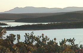
The estuary is around seven kilometres long from a rock bar in the narrow river valley to the mouth at the southern end of the lagoon. This Inlet is different from other estuaries in the Fitzgerald National Park as the lagoon floor is on average two metres below sea level, which as a consequence holds water a lot longer than other estuaries. This results in a more favourable environment for estuarine and marine animals, which flourish on the inlet.
The Hamersley River is the only river that flows into the inlet and flows mainly through the national park but has around 20% of its catchment cleared for agriculture in the upper headwaters.
Further Information:
South Coast Regional Land and Water Care Strategy: The Fitzgerald-Biosphere Sub-region. Prepared by the South Coast Regional Assessment Panel and the South Coast Regional Initiative Planning Team March 1997.