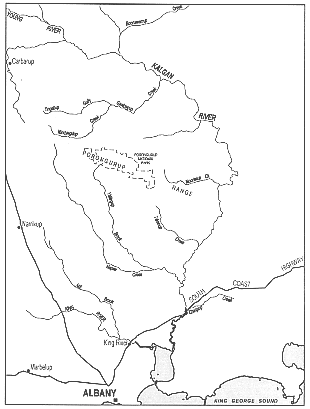
Kalgan River
|
The river winds from its mouth at the north-eastern corner of Oyster Harbour to the Upper Kalgan Bridge. A steep rock fall under the bridge separates the downstream section of the river from a one kilometre-long pool upstream. The nine kilometres of river downstream of the bridge are tidal and traverse a narrow rocky valley with steep, tree-clad slopes. This section of the river is 20-30 metres wide for the first kilometre from the mouth, widening to 100 metres about three kilometres upstream and then to 250 metres at the Lower Kalgan Bridge.
There are swamps and sandy shallows at the mouth of the river and upstream for a short distance. Boats can be launched to the Kalgan River about three kilometres from the Lower Kalgan Bridge, along a gravel road on the east bank. A water ski club operates in a gazetted ski area from this location. Spectator crowds and boat washing and launching have slightly degraded the foreshore. A rowing club and caravan park also exist in a Crown reserve just north of the Lower Kalgan Bridge.
Napier Creek joins the river from the west 5 km north of the Upper Kalgan Bridge. The creek extends 36 kilometres into the catchment.
There are many pools along the river and three islands lie in its lower reaches. A large part of the catchment lies in the low rainfall area away from the coast, so run off is low.
Although rain falls predominantly in winter, there can be floods in winter or summer. These high flow rates are significant because they carry heavy loads of sediment and nutrients to the harbour from the cleared catchment.
The river winds through agricultural land for most of its length. However, the steep banks of the river are mostly still well-vegetated. About a third of the river between Oyster Harbour and the Stirling Range is well-vegetated with a large number of native plant species and only a few introduced species. Although there are points of severe erosion in such areas, the river valley is generally healthy.
However, weed invasion, livestock grazing, trampling and frequent fires are degrading most of the river's length over the other two thirds of the river. Erosion and subsidence is increasing. In the upper section of the river salinity is a major problem, killing off large stands of trees, shrubs and sedges. In many places the less salt-tolerant vegetation is being replaced with salt-tolerant trees and saltmarsh species.
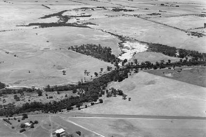
Upper Kalgan River: Cleared for agriculture
A shallow gorge is located along the lower part of the river just south of the Porongurup Range. It is about 6 km long and contains areas of pristine vegetation, exposed granite domes and cascades. The gorge is an area of high aesthetic value.
Foreshore areas are mostly in private ownership on the eastern bank of the river to the Upper Kalgan Bridge. A foreshore reserve extends along much of the western bank where subdivision has occurred. Upstream of the Upper Kalgan Bridge the majority of the river foreshore is in public ownership. There are two large reserves for the purposes of conservation of animals and plants and parklands along this section of the river and there is a large area of vacant Crown land.