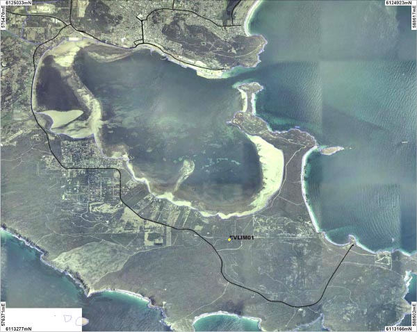
One site on Limeburners Creek was sampled. An overview of this site is shown on the map above. A photographs is available for the site:
| LIM01 |
The average annual rainfall across the catchment is 1100mm and the majority of the rainfall occurs over the winter months.
Limeburners Creek is a contributes towards the drinking water supply of Albany. The Limeburners Creek Catchment Area was proclaimed in 1959 under the Country Areas Water Supply Act.
The Limeburners Creek catchment typically consists of an Acacia scrubland.
The Limeburners Creek was sampled in September 2007.
Limeburners Creek is a fresh water system (0.8 ms/cm) with a neutral pH (7.14 pH). The Creek at the site sampled had a high level of turbidity that was 15.4ntu.
The Creek recorded low levels of both total nitrogen total phosphorus.
