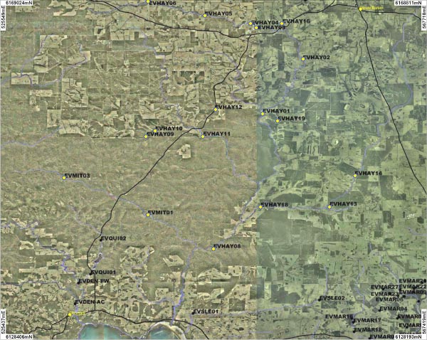
Nineteen sites on the Hay River and three sites on the Mitchell River were sampled. An overview of this sites is shown on the map above:
| HAY01 | HAY02 | HAY03 | HAY04 | HAY05 | HAY06 | HAY07 | HAY08 | HAY09 | HAY10 | HAY11 |
| HAY12 | HAY13 | HAY14 | HAY15 | HAY16 | HAY17 | HAY18 | HAY19 | MIT01 | MIT02 | MIT03 |
The headwaters of the River begin just north of Mount Barker and eventually flow into the Wilson Inlet.
The Mitchell River is a tributary to the Hay River and joins the Hay River 10 kilometres upstream from South Coast Highway crossing. The Mitchell River catchment is pristine condition is located in the Mount Lindsay National.
The River was sampled between June and September 2007.
Two fresh water crayfish species (Cherax preissii and Cherax crassimanus) were recorded in the both the Hay and Mitchell Rivers.
Pictures of these can be viewed in the gallery.
All sites on the Mitchell River, HAY13 and HAY17 recorded fresh water levels of conductivity. HAY03, HAY06 - HAY09, HAY11 - HAY14, HAY18 and HAY19 all recorded brackish levels of conductivity and all other sites were saline.
All sites on the Mitchell River, HAY04, HAY05, HAY12, HAY13, HAY14, HAY16 and HAY18 had an acidic pH levels between 3.8 and 6.48. All other sites were neutral.
MIT02, HAY11, HAY13, HAY15, HAY18 and HAY19 all recorded low level of turbidity. Very high levels were recorded at MIT01, HAY02, HAY03, HAY05, HAY07 and HAY14. All other sites recorded moderate or high levels of turbidity.
The level of total phosphorus recorded at all Mitchell River sites, HAY07, HAY08, HAY09, HAY15, HAY16, HAY17 was low. Moderate levels were recorded at HAY03 and HAY19. No other sites were sampled for total phosphorus.
Sites HAY02, HAY05, HAY06 and HAY08 all recorded moderate levels of total nitrogen and HAY03, HAY07, HAY17 all recorded high levels. Sites HAY13 and HAY15 were not sampled and all remaining sites recorded low levels of total nitrogen.
