Seven Mile Creek
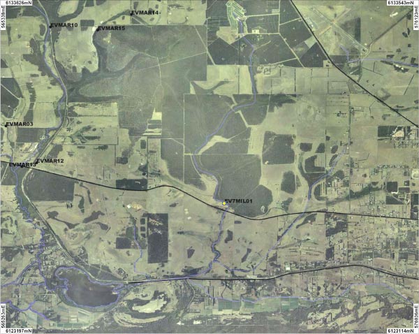
One site on Seven Mile Creek was sampled. An overview of the site is shown on the map above. A photograph is available for the site:
Background
Seven Mile Creek is located 10 kilometres west of Albany. The Creek flows to Lake Powell and eventually into the Torbay Inlet.
The Seven Mile Creek catchment typically consists of a Jarrah, Blackbutt and Sheoak forest with sedgelands along the main channel. Over 90% of the catchment has been cleared for agriculture, however, approximately 35% of the catchment is now under tree plantations.
The Seven Mile Creek was sampled in September 2007.
Fish
Night Fish, Western Pygmy Perch, Shrimp and Fresh Water Crayfish species
Cherax preissii were all found in the Creek. Pictures of these can be viewed in the
gallery.
River foreshore vegetation condition
The foreshore condition at the site sampled was determined to be slightly degraded and was in B grade condition.
Water Quality
Water samples were taken once from each site so while they help describe the water quality at the time of sampling they can not be used to explain the overall condition of the river for the rest of the time.
Seven Mile Creek is a fresh water system (0.6ms/cm) with a slightly acid pH (6.3 pH). The Creek recorded high levels of turbidity.
The site recorded very high levels of total phosphorus and high levels of total nitrogen.
