Walpole River
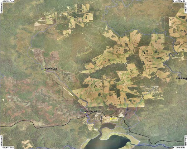
Two sites were sampled along the Walpole River. An overview of the sites is shown on the map above. Photographs are available for each site:
Background
The Walpole River lies north-west of the Walpole town site and covers an area of approximately 6700 hectares. The Walpole River and catchment is significant, in that it provides the water supply for the town of Walpole and some of the surrounding farmlands. The Walpole River is approximately 15.5 km in length and discharges into the Walpole Inlet.
The two sites were sampled in November 2007.
Fish
The Western Pygmy Perch was the only species found at both sites. Western Minnow and a Salamander fish were found at site WAL01 and Shrimp, Night Fish Marron and freshwater crayfish species
Cherax crassimanus was found at site WAL02. Pictures of these can be viewed in the
gallery.
River foreshore vegetation condition
The Walpole River is in pristine condition with both sites being in A grade condition. There was no evidence of degradation at either of the sampled sites.
Water Quality
Water samples were taken once from each site so while they help describe the water quality at the time of sampling they can not be used to explain the overall condition of the river for the rest of the time.
The Walpole River is a freshwater system with both sites recording salinity levels less than 0.4mS/cm.
The River is relatively acidic as both sites recorded a pH of 4.64 (WAL01) and 4.06 (WAL02).
Site WAL01 recorded a high level of turbidity and site WAL02 recorded a moderate level.
Both sites recorded moderate levels of total phosphorus and moderate levels of total nitrogen. Site WAL01 recorded levels of 29μg/L and 860μg/L for total phosphorus and nitrogen, respectively. Site WAL02 recorded levels of 42μg/L for total phosphorus and 770μg/L for total nitrogen.
