
|
Pallinup catchment |
| Overview | 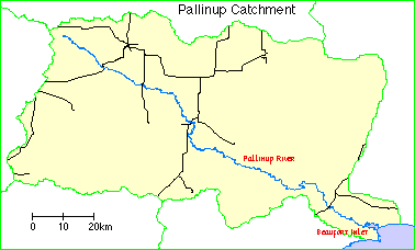 |
Waterways |
The Pallinup catchment comprises Beaufort Inlet together with the catchment of the Pallinup River and its tributaries.
Climate
Rainfall is relatively low, decreasing from around 600 millimetres on the coast to 400 mm. in the upper catchment. Unseasonal heavy rains and floods have a significant impact on the estuarine ecology.
Soils and landforms
The upper parts of the catchment lie in the Yilgarn Block of the plateau and the lower reaches are on the Albany-Frazer geological province. The hard granitic bedrock is exposed in the river valleys and along the riverine reaches of Beaufort Inlet. Within about 40 kilometres of the coast this rock is overlain by spongolite rock, composed of clays, sponge spicules, sand, and scarce fossil shells. This softer rock is more readily eroded and has been cut into steeply sloped valleys and cliff near the estuary.
Much of the catchment between the valleys is covered by sandplain. Calcareous, Pleistocene dune rock and recent mobile dune sands border the coast and the lower reaches of the estuary, where they overlie the older rocks.
Most soils are duplex, the sandy clay subsoil being overlain with topsoil ranging from sand to loam. Other soils are gradational with clay-loam or clay topsoils. Almost all are well-drained and, except for the heavy soils, are acidic with a pH of 6.0 - 6.5. Most bare soils on slopes of more than two degrees are readily eroded; the topsoil of sand or loam lacks sufficient clay to bind against erosion by water and wind.
Lighter soils are common on the sandplain. In some places the topsoil of almost pure sand is more than 30 centimetres deep.
Young soils are present on the middle and lower slopes of the Pallinup River and its tributaries. The topsoil is loamy sand.
Flora
Mallees are common on the sandplain. Near Beaufort Inlet redheart mallee grows on fine, loamy soils.
York gum is common near the Pallinup River, with flat-topped yate often on lower slopes near drainage lines. Small patches of flooded gum can be found on the north-western tributary of the Pallinup River. The swamp oak is also common along the river.
Land use
Initially, small-scale clearing for agriculture along the Pallinup River took place in the mid-1800s. It was not until a century later that there was widespread clearing on the sandy soils of the northern catchment area. This involved broadscale removal of all the bush, transforming the area. The greater part of the catchment is now mainly used for cereal production and sheep grazing.
The towns of Gnowangerup, Borden and Ongerup are in the upper catchment area, and the small settlement of Millers Point is on the north shore of Beaufort Inlet.
Wetlands Surveys
The following wetlands in the catchment have been surveyed and "report cards" prepared. The reports are available as PDF files. The locations of the wetlands can be seen on the survey map and in the overall survey report.
Management Reports
Management recommendations:
in Peniup Creek Survey Department of Water [unpublished]
in State of the Pallinup River and Beaufort Inlet WRM 37 (2003) Department of Water
Foreshore survey:
in Pendenup Creek Survey (2000) Department of Water (unpublished notes)
in Save the Bush - South Coast River Corridor Project (1991/92) John Watson and Sylvia Leighton (unpublished?)
Copies of these reports are available from the Albany office of the Department of Water.
