|
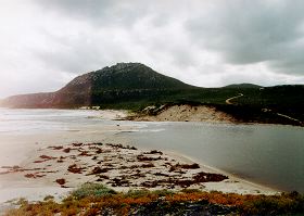
Culham Inlet |
|
|
Culham Inlet is shallow and often dries out in summer. It generally fills up from winter rainfall, and may even hold water for several years (as in 1988 and 1989). The inlet is oval in shape and is approximately 11.3 square kilometres. In most areas the water level is less than one metre deep. There was about 4.5 metres of water in the centre of the Inlet in August 1989. The Phillips River is considerably deeper in places, eight metres or more near the cliff at seven kilometres. The Culham Inlet extends seven kilometres up the Phillips River, which is deeper, and always holds water. The smaller Steere River is estuarine for about two kilometres.
Flora and Fauna
When the salinity levels in Culham Inlet are favourable, there can be an abundance of the few species of fish and other salt tolerant estuarine fauna such as black bream, some hardyheads, gobies and their invertebrate prey. Populations of sea mullet and a few other species of fish are recruited from the sea when the bars break and may flourish for months or years until the water becomes too saline. Black bream and smaller native fish come down with the floodwaters from river pools and at times are very abundant. When it evaporates the water that remains in the estuaries becomes too saline for all but a few marine or estuarine animals to survive. The inlet is also an important feeding place for great numbers of waterbirds when there is water in it.