|
 |
Steere River |
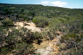
The Steere River flows into the Culhum Inlet to the east of the Phillips river and drains mostly rugged hilly country of mineral rich, Archaean volcanic and sedimentary rock, which is mainly vegetated. In the lower parts of catchment the river drains more gently undulating country and is join from the west by its tributary the Waindettup creek, which drains mostly, cleared farmland to the north. Most of the eastern side of the Steere river in the lower catchment is cleared for farmland of mainly wheat and sheep. In floods the waters back up the river from the estuary around two kilometres over a road crossing which in some years can become impassable for normal traffic for up to two months.
In 2005 a project (Our Living Rivers) was set up to collect and analyse data, enabling the Department of Water to monitor the health of the river over time and help determine what systems need better protection. In spring 2006 and 2007 samples were taken from the river system to assess the quality of the water and habitat as well as the presence of fish and macroinvertebrates. One site was sampled on the Steere River.
Further Information:
South Coast Regional Land and Water Care Strategy:
The Fitzgerald-Biosphere Sub-region.
Prepared by: the South Coast Regional Assessment Panel and
the South Coast Regional Initiative Planning Team March 1997.