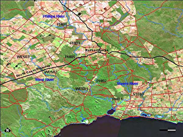
There were five sampling sites on the Phillips River system, three on the West River and one on the Steere River; they are shown on the map above. Photographs are available for each site:
| PHI01 | PHI02 | PHI03 | PHI04 | PHI05 | WES01 | WES02 | WES03 | STE01 |
The Steere River originates in the Ravensthorpe Range in the vicinity of Elverdton and in a subdued stony plateau west of Elverdton. As such it is one of the shortest south coast rivers with a main channel length of 30 kilometres and a catchment area of 36 000 hectares of which 30% has been cleared for agriculture. All the upper catchment is uncleared bushland, a very small proportion of which has been severely impacted by mining activity. The median annual rainfall in the catchment is 450 mm and the mean annual flow estimate is 1,400 ML. (This information is from Andy Chapman's Steere River Condition Assessment, 2007).
The Phillips, West and Steere rivers were sampled on the 3rd to 5th of October 2006 and the 7th of September 2007.
Vegetation surveys along each of the rivers suggest that the vegetation corridors along the rivers form an important link from the coast to the inland areas. In the case of the Phillips and West rivers, the foreshore vegetation is generally in very good condition with most fenced off from adjacent farmland. A recent assessment of the Steere River and its tributaries found that weed infestation was degrading the main river channel and that the tributaries showed additional manifestations of degradation including erosion, excess sediment transport, secondary salinisation and water impoundment.
The water temperature at the time of sampling ranged from 13 to 21.5°C.
Salinity was very low (3.45ppt) in the pool on Carracarrup Creek (site PHI02) where the tadpoles were found. The remainder of the sites on the Phillips River had high salinities from 32ppt up to 69ppt which is well over seawater at 35ppt. The West River had salinities decreasing from 72ppt at the most upstream site on the river to only 12ppt at the lowest site where the West River is in the national park. The site of the Steere River (STE01) had a low salinity (9.8 ppt) compared to the other two rivers.
The water measured ranged in acidity from pH 6.58 to pH 8.83 which is close to neutral (pH 7) to slightly basic.
Nutrient levels were greatest for both nitrogen and phosphorus at site WES03 which is higher up in the West River catchment. The Steere and lower West River sites had the lowest levels at 7-8 µg/L phosphorus and 730 µg/L nitrogen. The West River had reducing nutrient levels as the sites went downstream but for the Phillips River nutrient concentrations remained high with the lowest site, which is connected to the inlet, had 75 µg/L phosphorus and 3000 µg/L nitrogen.
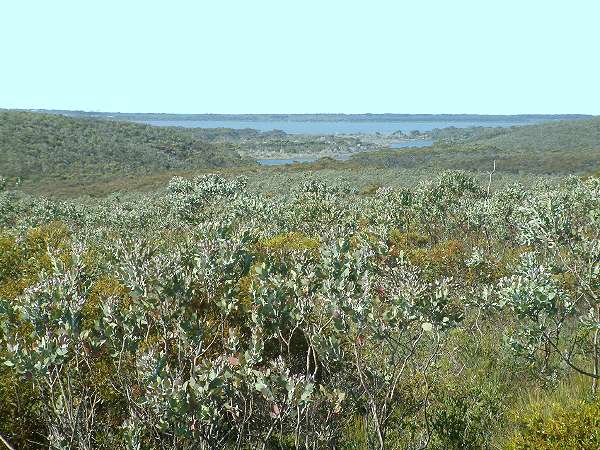
5th November 2006: Culham Inlet, the receiving estuary for the Phillips, West and Steere Rivers.
