
|
Frankland catchment |
| Overview | 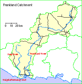 |
Waterways |
The Frankland catchment comprises the Walpole/Nornalup Inlet together with the catchments of the Deep and Frankland Rivers and their tributaries plus some of the small creeks, drains and land which drains to the inlet.
Climate
Rainfall decreases progressively inland from the coast, with nearly 1400 millimetres a year, to less than 500 mm in the north-eastern part of the catchment. This is mainly winter rainfall, but there are occasional summer storms. There has been a gradual decrease in rainfall in the lower catchment since the early 1950s - a decrease of approximately 200 mm.
Soils and landforms
The catchment lies on the southern edge of the Western Shield plateau. The area north of the Muir Highway is open, gently undulating country about 300 metres above sea level, with granite outcrops and laterite residuals. South of the highway the land is hilly, mainly forested country with valleys that become deeply incised as they approach the coast. The coastal strip is formed by dunes between steep granitic headlands that are outliers of the plateau.
Most of the lower rainfall area north of the Muir Highway is occupied by sandy or loamy yellow duplex soils with moderate slopes and so the erosion risk is high in summer. The southern third of the the Frankland River catchment and that of the Deep River is a hilly, dissected part of the plateau with a thin laterite cover and leached sandy and gravelly soils. Erosion is normally low under the forest cover, though there is a slight risk of sediment movement with clear felling operations.
Flora and fauna
Flora
Much of coastal and dune country is covered with peppermint (Agonis flexuosa) scrub or woodland with some open heath. Inland from the dunes stands of karri with red tingle, marri or jarrah dominate higher ground. Lower sandy ridges carry banksia woodlands, while low ground is occupied by paperbark and sedge swamps.
Karri forest covers hilly country in the southern part of the forest, giving way to jarrah and marri forest northwards. Blackbutt and bullich occur in damper valley floors and along streamlines. Throughout the forest, broad swampy drainage lines and open sandy flats subject to seasonal inundation carry a low open woodland of melaleucia and banksia, with an understory of heaths and sedges.
The Walpole-Nornalup National Park, which is within the catchment area, is an area of considerable floral diversity. Around 700 native species occur in the park, including a high proportion of geographically restricted high rainfall species. The Park is one of the richest reserves for orchids of any area of Australia.
Fauna
Walpole-Nornalup National Park is an important area for fauna conservation because of its pristine state and continuity with surrounding uncleared lands. There are a wide range of habitats and corridors for migration. Nineteen species of native mammals, 109 species of birds, 22 species of reptiles and 12 species of frogs have been identified in the park.
A number of threatened fauna species occur in the Park. These include the southern brown bandicoot, quokka and possibly western ringtail possum and chuditch.
Land use
A total of 54% of the catchment had been cleared for agriculture by 1968. By 1982, 85% of the Frankland River catchment had been cleared above the Frankland River gauging station. Most of this land is alienated agricultural land, used for cereal crops, sheep production and viticulture.
South of the Muir Highway, most of the catchment is in state forest and only small areas have been cleared. However, there have been significant bush fires over most of the area in the 1980s. Logging activity has been widespread through the forests, currently concentrating in the karri-marri forest.
The town of Walpole lies within the catchment area, covering two square kilometres on the northern shore of the Walpole Inlet.
Management Reports
Action plans:
Foreshore surveys:
Copies of these reports are available from the Albany office of the Department of Water.
