|
Kent River |
| Kent River at a glance | |||
| Catchment area: | 1830 square kilometres |
||
| Average annual catchment rainfall: | 600-1400 millimetres | ||
| River length: | 100 kilometres | ||
| Annual discharge into Owingup Swamp: | 90,000 Megalitres | ||
| Percentage cleared: | 52% | ||
| River health: | very saline in upper reaches | ||
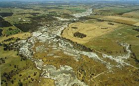
South of the Yilgarn Plateau, the Kent River flows through over 30 kilometres of forested, dissected granite country, with some extensive swampy patches, before cutting through siltsone to the coastal plain. There is some clearing in the rivers' lower reaches and on the coastal plain, but in this high rainfall area (up to 100 millimetres) the water contributed to the river is fresh. At its mouth, where it flows through Owingup Swamp on the coastal plain, and into Irwin Inlet, the Kent River is brackish, a combination of the saline water from the inland agricultural area and the fresh water from the catchment. The river has been degraded by loss of vegetation, erosion and sedimentation in areas cleared for agriculture, but the forested sections are in good condition and have some value for recreation.
The Owingup Swamp, about six kilometres east of Irwin Inlet, acts as a sediment and nutrient trap for Kent River water, reducing the level of both discharged into Irwin Inlet. The Owinup Swamp has an organic clay substrate, and in 1960 an evalution of the swamp suggested that it was suitable for agricultural development. Development of the swamp did not occur and it is now vested with the National Parks and Nature Conservation Authority as part of the Quarrum Nature Reserve.
In 2005 a project (Our Living Rivers) was set up to collect and analyse data, enabling the Department of Water to monitor the health of the river over time and help determine what systems need better protection. In spring 2006 and 2007 samples were taken from the river system to assess the quality of the water and habitat as well as the presence of fish and macroinvertebrates. Three sites were sampled on the Kent River system, one site on the Styx River and one site on the Nile River..
Further Information:
South Coast Regional Land and Water Care Strategy: The Kent-Frankland Sub-Region. Prepared by: the South Coast Regional Assessment Panel and the South Coast Regional Initiative Planning Team: December 1996